The start of my 4000-mile trip: Getting to Newark (Update II)
After my previous ride from Paulus Hook to Newark, discussed in The start of my 4000-mile trip: Getting to Newark (Update), I had still not decided whether I would begin my adventure with a ride on the ferry from Battery Park City to Paulus Hook, or with a ride on the PATH train from my neighborhood to Newark, thereby avoiding a few miles of riding on sidewalks filled with debris. On March 11th I rode from Battery Park City to Paulus Hook following the route I created after my previous ride on February 4th. The March 11th trip began with a glorious ride on the ferry across the Hudson, much of it spent on the upper deck. It was a sunny day and I thought that I might soon be starting my three-month adventure seeing Manhattan and New Jersey from this point of view.

The modification I made to my previous route in order to avoid a cinder path marked with a sign saying OFFICAL AND EMERGENCY VEHILCLES ONLY just before the path along the bridge over the Hackensack River worked well. After the Hackensack River I rode across an exit ramp onto Hackensack Avenue, but it's safer to ride on, rather than across, the exit ramp and then make a left onto Hackensack Avenue followed by a right onto the sidewalk on the south side of Route 9. I also realized that it's better to ride in the roadway rather than on the sidewalk obstructed by overgrowth and garbage in the half mile before Raymond Boulevard. Near the end of the route I discovered that the bike path just north of Raymond Boulevard makes it possible to avoid the dangerous intersection with Jackson Street. I have created another route from Paulus Hook to Newark that incorporates these improvements which you can find here.
I had planned to ride from Newark back to Paulus Hook but decided I had enough of dealing with debris on sidewalks for one day, so I took the PATH train to Journal Square and used Google Maps to plot a route to the GW Bridge. Unfortunately I specified biking directions, in which case Google Maps does its best to avoid traffic, even if it means using bike paths made of bricks. When I encountered such a path I remembered that I had realized last summer that Google Maps usually works best when I specify driving directions avoiding highways. You can see my ride here, the recording of which stopped before I got all the way home, probably because the storage on my phone was full. So this trip reinforced my understanding of how to best use Google Maps when I need to find a new route (I create my routes at www.ridewithgps.com but the ridewithgps app does not have that capability) and showed me how important it is to have plenty of storage space on my phone.
So, will I start my adventure with a trip on the ferry across the Hudson followed by some riding on sidewalks so filled with debris that occasionally I need to walk my bike? Or will I take the PATH train from Chelsea to Newark in order to avoid that unpleasant riding? Unless it's raining when I depart (which would turn the dirt on the sidewalks into mud) I think it will be the former, in which case I will start my trip with the route found here and shown below.


The modification I made to my previous route in order to avoid a cinder path marked with a sign saying OFFICAL AND EMERGENCY VEHILCLES ONLY just before the path along the bridge over the Hackensack River worked well. After the Hackensack River I rode across an exit ramp onto Hackensack Avenue, but it's safer to ride on, rather than across, the exit ramp and then make a left onto Hackensack Avenue followed by a right onto the sidewalk on the south side of Route 9. I also realized that it's better to ride in the roadway rather than on the sidewalk obstructed by overgrowth and garbage in the half mile before Raymond Boulevard. Near the end of the route I discovered that the bike path just north of Raymond Boulevard makes it possible to avoid the dangerous intersection with Jackson Street. I have created another route from Paulus Hook to Newark that incorporates these improvements which you can find here.
I had planned to ride from Newark back to Paulus Hook but decided I had enough of dealing with debris on sidewalks for one day, so I took the PATH train to Journal Square and used Google Maps to plot a route to the GW Bridge. Unfortunately I specified biking directions, in which case Google Maps does its best to avoid traffic, even if it means using bike paths made of bricks. When I encountered such a path I remembered that I had realized last summer that Google Maps usually works best when I specify driving directions avoiding highways. You can see my ride here, the recording of which stopped before I got all the way home, probably because the storage on my phone was full. So this trip reinforced my understanding of how to best use Google Maps when I need to find a new route (I create my routes at www.ridewithgps.com but the ridewithgps app does not have that capability) and showed me how important it is to have plenty of storage space on my phone.
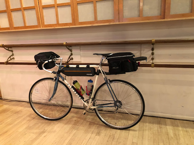
So, will I start my adventure with a trip on the ferry across the Hudson followed by some riding on sidewalks so filled with debris that occasionally I need to walk my bike? Or will I take the PATH train from Chelsea to Newark in order to avoid that unpleasant riding? Unless it's raining when I depart (which would turn the dirt on the sidewalks into mud) I think it will be the former, in which case I will start my trip with the route found here and shown below.

Comments
Post a Comment