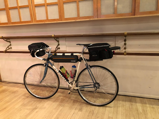
Riding Day 27 - July 4th, 2019
Start: Murfreesboro,TN
End: Burns, TN
Miles: 67.4
Feet climbing per mile: 60
Record of today’s ride: https://ridewithgps.com/trips/36814391
I enjoyed my dinner last night at the Parthenon Grill but I felt not so well through the night, and this morning I woke up with swelling around my eyes. I suspect the food was much saltier than I had thought.
At about mile 10, I encountered a short but very steep climb. The rest of the day was full of curving roads and rolling hills. Often there was a usable shoulder. I don’t have to have a shoulder to be safe, but it helps.
Google Maps for bicycles has generally given me good, even excellent, routes, but sometimes they avoid highways at the cost of crossing a busy highway without the help of a traffic light, and other times they take shortcuts onto roads poorly paved. I need to more carefully examine the routes before I head out, preferably when I have access to a computer so I can make necessary modifications.
It was fun to see the town of Franklin celebrating Independance Day, although I was disappointed the ice cream shop would not open until 11:00. I wasn’t willing to wait 40 minutes.
I forgot to mention yesterday that when racing down the mountain I imagined myself as one of the competitors in the Tour de France. I’m becoming a descender as well as a climber.
I'm spending the night at Montgomery Bell State Park. Having completed more than a third of my journey, I wonder how re-entry into normal life will be.
End: Burns, TN
Miles: 67.4
Feet climbing per mile: 60
Record of today’s ride: https://ridewithgps.com/trips/36814391
I enjoyed my dinner last night at the Parthenon Grill but I felt not so well through the night, and this morning I woke up with swelling around my eyes. I suspect the food was much saltier than I had thought.
At about mile 10, I encountered a short but very steep climb. The rest of the day was full of curving roads and rolling hills. Often there was a usable shoulder. I don’t have to have a shoulder to be safe, but it helps.
Google Maps for bicycles has generally given me good, even excellent, routes, but sometimes they avoid highways at the cost of crossing a busy highway without the help of a traffic light, and other times they take shortcuts onto roads poorly paved. I need to more carefully examine the routes before I head out, preferably when I have access to a computer so I can make necessary modifications.
 |
| Overpass of the Natchez Trace Parkway at mile 44 |
It was fun to see the town of Franklin celebrating Independance Day, although I was disappointed the ice cream shop would not open until 11:00. I wasn’t willing to wait 40 minutes.
I forgot to mention yesterday that when racing down the mountain I imagined myself as one of the competitors in the Tour de France. I’m becoming a descender as well as a climber.
I'm spending the night at Montgomery Bell State Park. Having completed more than a third of my journey, I wonder how re-entry into normal life will be.


Comments
Post a Comment