Day 69: September 12, 2024 - Giant City State Park to Elizabethtown, IL
End: Elizabethtown, IL
Miles: 79.3
Feet climbing per mile: 61
Record of the day's ride: https://ridewithgps.com/trips/220713988
As I began the day’s ride I wasn’t sure whether I would spend the night at Cave-in-Rock (90 miles away), Elizabethtown (70 miles miles away), or Golconda (55 miles away).
When I turned from highway 51 onto 146 I quickly discovered that the latter, with no shoulder, had lots of traffic, including big trucks, in both directions. I created and began to follow a new route that would avoid 146. It had little traffic but would add ten miles regardless of which destination I chose. I was soon on the road in the picture below.

I stopped at the Goreville Grille and had a piece of strawberry pie.

Later I met Cormac, who was riding east-to-west a variation of the Trans Am Bike Route.

Southern Illinois has some rock formations, although the ones I saw do not compare to those out west.

The bridge was not outstanding as a bridge but it was a distinctive feature of my ride.

Here’s another rock formation.

Who needs a tug boat?

A few hours into my ride I called the lodge at Cave-in-Rock and learned that the least expensive accommodation would cost more than $200. Camping there was an option but I wasn’t interested in doing that after riding 90+ miles and arriving at maybe 6:00. I called the Rose Hotel in Elizabethtown and told Becky, with whom I had spoken the day before, that I wanted to stay at her place.
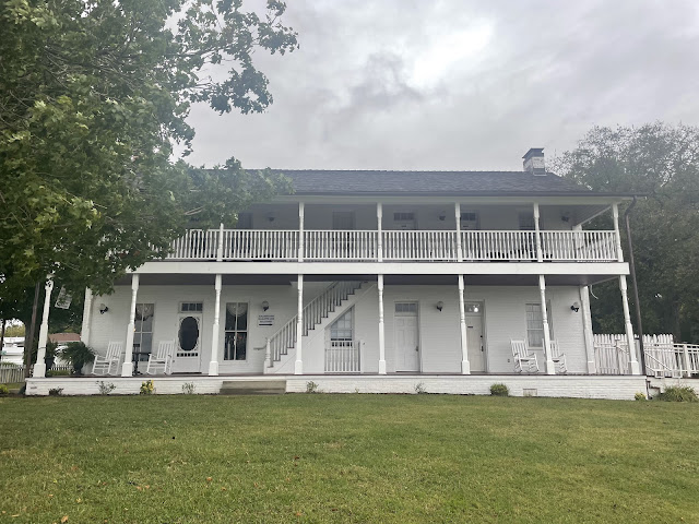
I arrived at the Rose Hotel having ridden almost 80 miles. Becky told me I would be in the Mammy Rose room on the first floor so I wouldn’t have to carry my bike up the stairs. She also told me a little history about the hotel which had been built in 1812.

Here was my view of the Ohio River from my door.

I got my dinner at the Hardin County BBQ which I discovered was take-out only, so ate in my room. I bought my dessert of ice cream at Riverside Mercantile.
I don’t know whether I’m still acclimated to high elevation, but I certainly found it easier to ride hard at low elevation. This ride of almost 80 miles was my longest to date on this trip, and there was substantial climbing, but it was not nearly the most difficult ride. It was good know I could ride 80 miles and not be entirely exhausted.
Follow my progress on this map. Click VIEW ALL and then pinch the map to see my progress from the start in Portland.
Follow me on Facebook here.
If my blog posts provide you with vicarious pleasure, please consider making even a small contribution towards the cost of my trip (which I now expect to be at least $12,000) by clicking the GoFundMe graphic below. Every contribution helps!
Please share my blog with anyone you think might be interested.
If you post a comment, please identify yourself,
preferably by using your Google account.


Comments
Post a Comment