Day 76: September 19, 2024 - Monteagle, TN, to Chattanooga, TN
End: Chattanooga, TN
Miles: 54.2
Feet climbing per mile: 57
Record of the day's ride: https://ridewithgps.com/trips/222959307
In my previous post I forgot to write that I was stung by a bee. While I was riding I felt a sudden sharp pain in my right side. Thinking I had been bitten by a bug, I stopped and looked for the trouble maker but found none. Then I felt a pain on the right side of my pelvis, found a bee in my shorts, and killed it. I don’t see how the bee could have gotten inside my shirt which was snuggly closed at the arms and the neck, and I don’t see how it could have gotten into my shorts. If you have a hunch, please write it as a comment below this post.
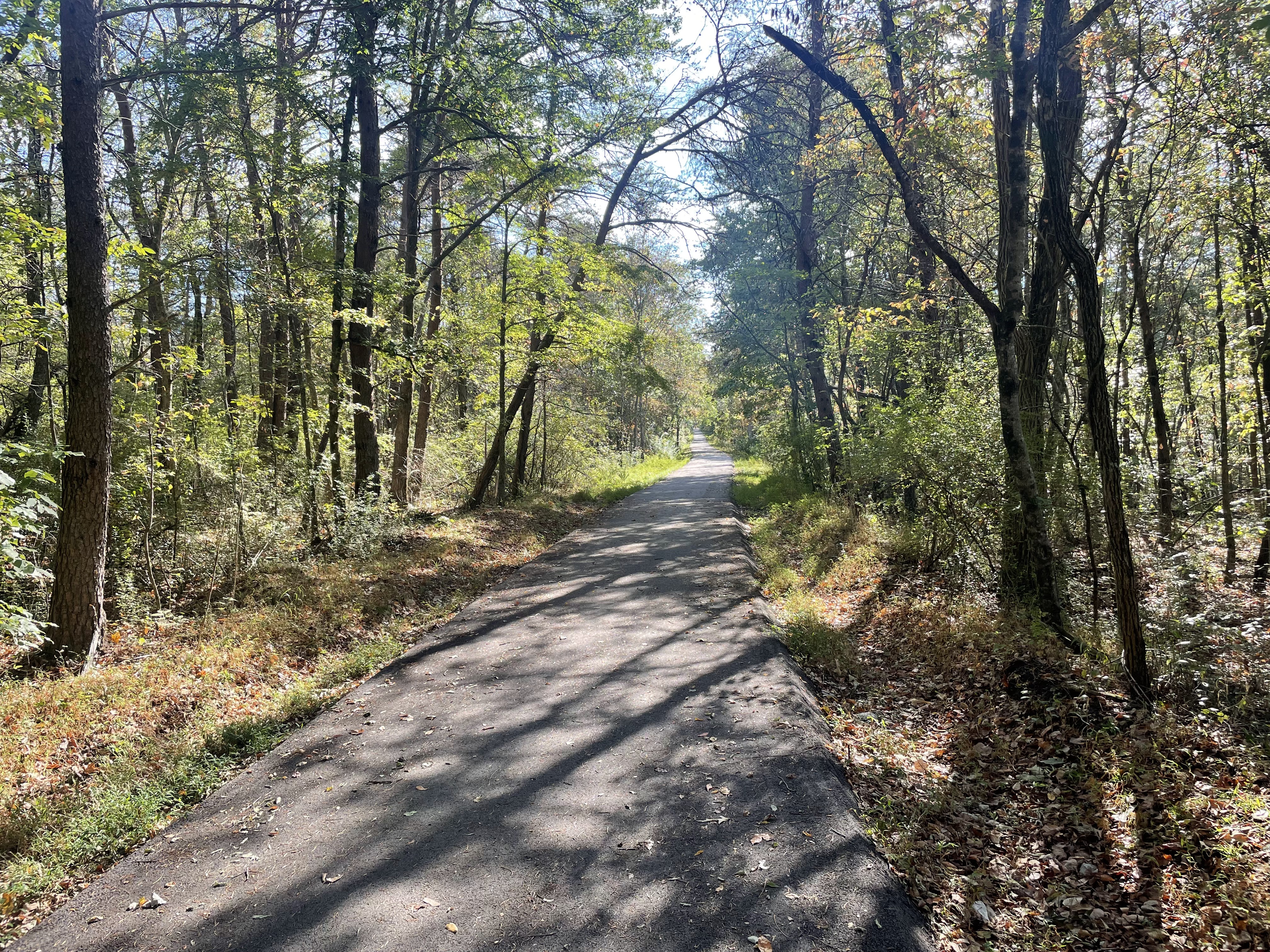
The hotel in Monteagle (pronounced MONT-igel, by the way) was not part of my original plan, so for today I used RideWithGPS to modify my route from Foster Falls to Chattanooga to start at the hotel. I hadn’t examined the beginning of the route, and as I rode it I discovered some things I would have cleaned up. But a pleasant surprise was a well-paved bike path, which I would usually not ride but this day I decided to do so.
I had considered making a stop Foster Falls Recreation Area in order to enjoy a morning swim in its beautiful swimming hole, but I forwent doing so. I did stop a few miles later at Mountain Mart, where I bought my dinner five years ago, to fill my water bottles, to have a Monster, and to buy a brownie for later.
The three outstanding features I expected for this ride were a steep descent of a few miles early in the day, and then a steep climb of a few miles followed by another steep descent of a few miles. Unfortunately the first descent was on broken chipseal, so I had apply my brakes the entire 2.4 miles.
I don’t often take pictures of clouds but these clouds caught my attention after the tortuous descent.

For the 4.6-mile climb I decided to apply the same strategy that allowed me to ride the all the way up to Hoosier Pass: I would ride as slowly as possible and occasionally stop to allow my heart to low and my breathing to normalize.
The climb was on a beautiful road with lots of trees and some rock formations.

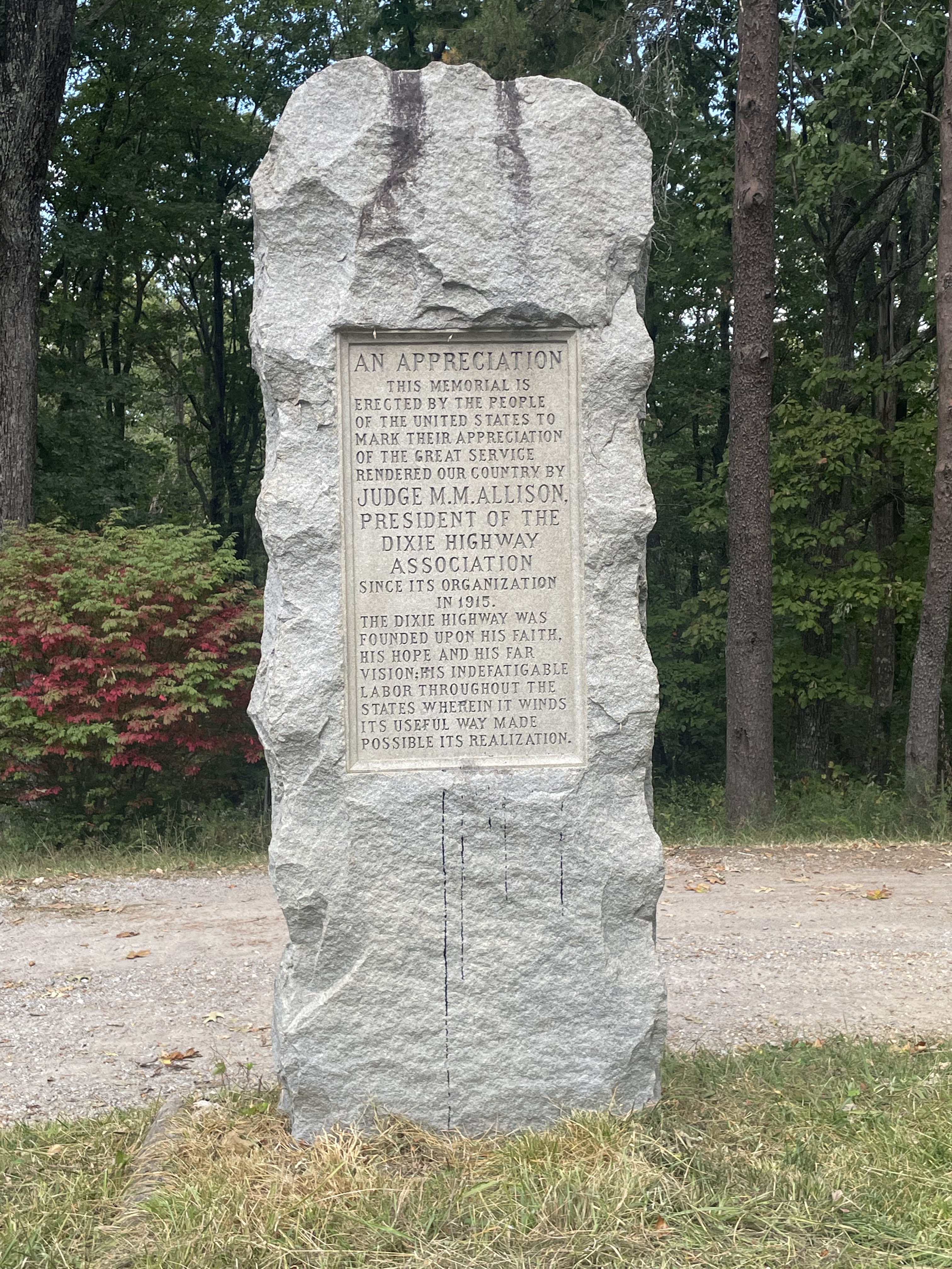
Following the strategy I described above I was able to ride the entire climb to what in the West would be called Suck Creek Pass. I thought that it might have been more difficult than Hoosier Pass, despite its much lower elevation, perhaps due to my bike being fully loaded. There was no sign to mark the summit and tell the elevation (about 2,000 feet), but there was a monument to Judge M. M. Allison.
The 5.4-mile descent was on an excellent surface, and I rode it at 20 to 30 miles per hour. Because of the curves and the moderate traffic the descent was mentally demanding.
After the descent I was on a road with rush-hour traffic. Although I thought that I had created my route by reversing the route I took out of Chattanooga five years ago, none of this seemed familiar. I thought that I must have changed the route from what I rode five years ago. Later I was surprised to discover that was not the case.
In order to avoid overwhelming traffic I used Google Maps to reroute to Trek Bikes from which I had ordered cleats a few days ago. I also had them install the cable for the rear derailleur that I bought in Murfreesboro after I saw that the cable was starting to fray at its front end. Thank you, Stephen, for setting aside the cleats and for having your mechanic install the cable while I waited.
The route from the bike shops to my final destination was on calm roads and took me over a bridge I recognized.

I spent the night at The Crash Pad where I stayed five years ago. When I made a reservation for a lower bunk I said that I might want to stay two nights, but when I arrived and confirmed my desire to stay a second night, I was told all the lower bunks were booked for the next night. I therefore took the upper bunk.

Here’s my storage locker.

I had dinner at Slick’s Burgers.
Follow my progress on this map. Click VIEW ALL and then pinch the map to see my progress from the start in Portland.
Follow me on Facebook here.
If my blog posts provide you with vicarious pleasure, please consider making even a small contribution towards the cost of my trip (which I now expect to be at least $12,000) by clicking the GoFundMe graphic below. Every contribution helps!
Please share my blog with anyone you think might be interested.
If you post a comment, please identify yourself,
preferably by using your Google account.

I can't figure out how the bee got under your clothes, but insects do surprising things.
ReplyDeleteI like mentally challenging descents like yours, as long as traffic isn't too heavy. Do you also like them?
Of course! Who goes up gets to come down!
DeleteCrazy elevation today. Great to see your progress.
ReplyDeleteGary, Vienna, Va